With thousands of peaks scattered across the California Sierra, I often find myself gazing at distant summits during hikes and wondering if that random mountain on the horizon would be worth the climb. This is how I discovered Red Slate Mountain back in 2021 when I did the John Muir Trail. While coming over a pass near Mammoth Lakes I saw a peak off in the distance, looming above me and shrouded in clouds, and I knew I’d be back to climb it someday. It was easy to determine that the peak I saw was Red Slate Mountain — although it’s “only” 13,140 feet above sea level and not a 14er, the Mammoth Lakes region tops out at around 13k and Red Slate is the highest thing in the area. After returning to civilization it was then exciting to learn that not only is Red Slate a mountain that people climb, but also has a lovely Class 1-2 trail all the way to the summit.
The Trail
Red Slate Mountain on Alltrails
The trail up Red Slate is absolutely beautiful. The approach is long (10.8 miles one way) and has significant elevation gain (5,918 feet), but most of the climb is gradual with the exception of the last mile from McGee pass to the summit. This mountain has all of the grandeur of Mount Whitney without all of the people, permits, and poop bags. From the trailhead to McGee pass, the trail is Class 1 and gradually climbs from 7,800 feet above sea level to 12,000 feet. It’s easy enough for a horse to do it, and since this is a common packhorse route to access the JMT you’ll see some horse poop along the way. Once you reach the pass it’s a class 2 climb from 12,000 feet up to the summit at 13,140. The class 2, although relentless, has fairly solid rock all the way to the top and really no exposure to worry about. If you’ve done any class 2 before, this should be child’s play. I wore a helmet in case there was a rogue rock but no one else on the mountain even bothered to put one on.
Trip Report
Since I was ultimately going back to Santa Barbara and my hiking partner, Chloe, was returning to Los Angeles, we met in the bustling city of Lancaster and dropped off my car at the Lancaster Walmart to carpool the rest of the way. It used to be that you could live in Walmart parking lots and do general dirt bag things like leave cars for weeks at a time; but now according to Reddit this era is no more, and several Walmart store managers do sweeps of their lots on the regular. We took our chances though and got lucky.
We stopped in Mojave on the way up to the trailhead to get gas. Mojave is one of the saddest towns in all of California. The town’s lone main street is flanked by nothing but gas stations and fast food chains. To your left run the Union Pacific and BNSF freight lines, recently thrust into the spotlight after desert bandits orchestrated a daring $2 million theft of Nike sneakers from passing trains. To your right is the Mojave Air and Space Port that has a “boneyard” of decrepit commercial aircraft where planes are scavenged for parts. There’s something truly sad and eerie driving through a desert and seeing hundreds of planes parked in the sand, their United and Delta logos fading away in the baking heat.
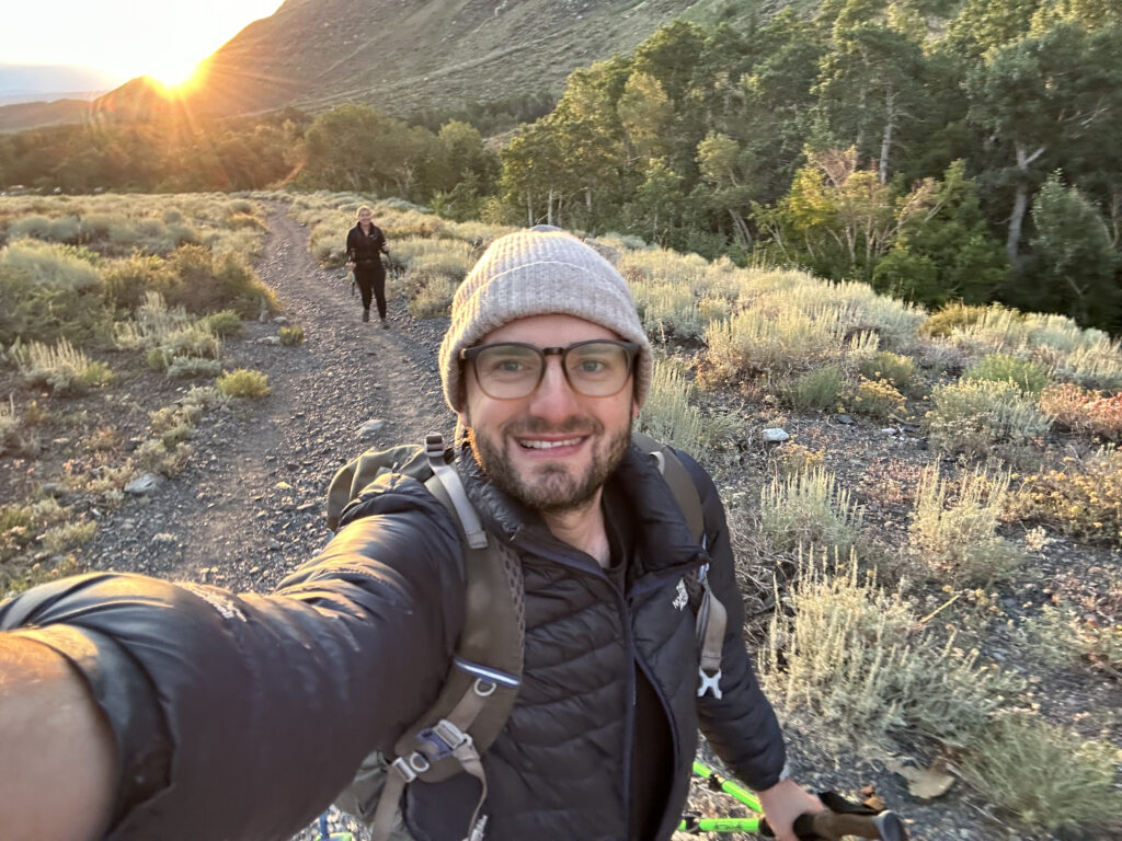
We made it to the trailhead around midnight — Chloe slept in the car and I set up my tent in the one flat spot in the entire area, the island in the center of the parking lot. I slept terribly as one does while sleeping on parking lot islands, and was suddenly woken at 4 AM by car headlights of an arriving party looking to get an early start. At this point I couldn’t go back to sleep (what if the next car drives straight over my island?!) and so I waited in my sleeping bag for my 5 AM alarm. The moment the alarm went off I was out of there, dumped my tent into the car, made a quick breakfast and did some gear reshuffling, and hit the trail right at 6 AM.
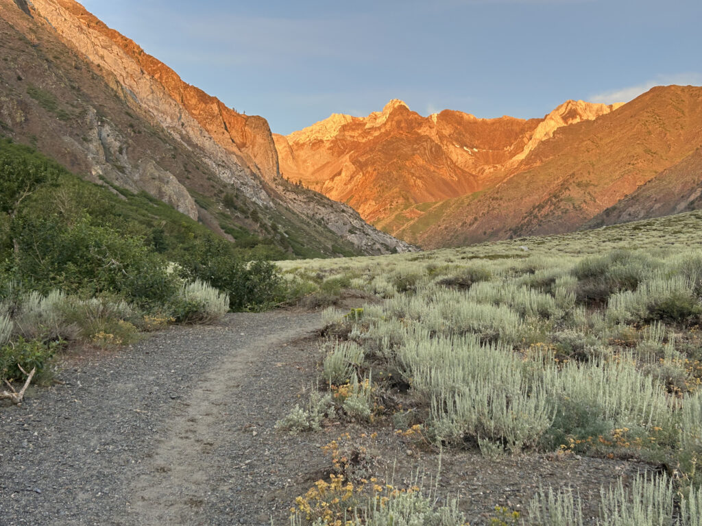
After the depressing Mojave, the five hour drive, and four hours of sleep on a parking lot island, I began to wonder why I’ve selected this as my hobby, but those concerns melted away the instant we hit the trail. We started right as the sun was coming up and the surrounding landscape was bathed in the golden light of dawn, the mountains glowing red and the birds whistling through the aspens along the river. This is why John Muir fell in love with the Sierra. It helped that we were also knocking off miles at lightning speed — the first three miles we finished in an hour, and we hit the 8 mile mark in the first 3 hours, while steadily gaining elevation the entire way.
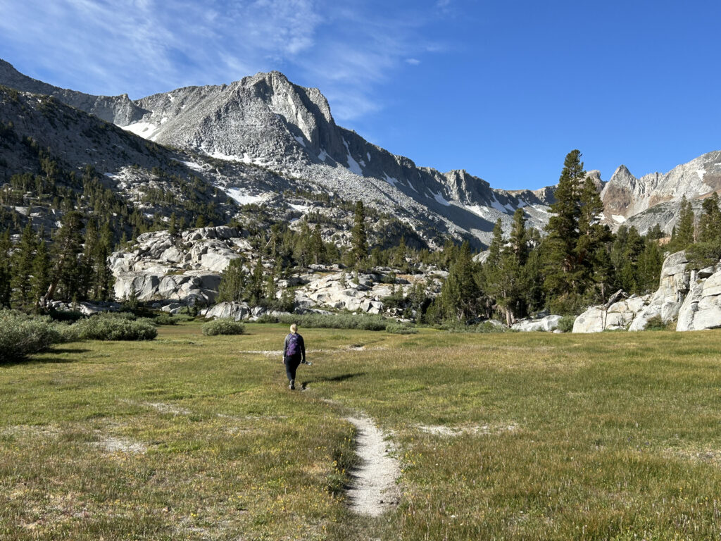
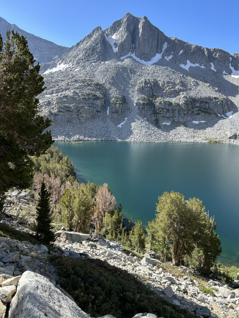
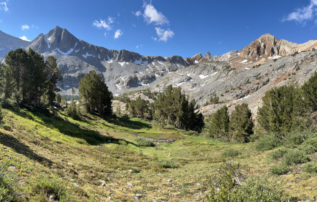
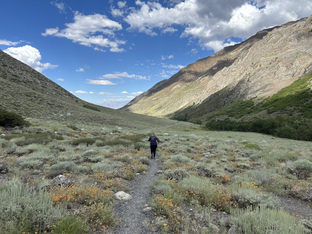
At first the trail followed the creek closely, but then ultimately diverged to climb a series of ridges up to Big McGee Lake. There is a whole cluster of lakes up here, so unsurprisingly we were swarmed by mosquitoes once we hit the lake. These mosquitoes accompanied us from miles 3-7 (and back down) and were particularly relentless, following us until we hit treeline. At one point the trail opened up to a large and picturesque meadow.
After crossing the meadow you hook right (west) and begin a much steeper climb above Big McGee Lake. There is a spur trail that leads down to a campsite at Big McGee Lake that we did not take; but with the number of mosquitoes I cannot imagine who survived the night there.
At this point we hit treeline. There’s a section of most Sierra trails, somewhere between 11,000 and 12,000 feet above sea level where the trees drop away but there is still life in the form of meadows, shrubs, and lichen covered rocks, adorned by waterfalls cascading from the melting snow up above. These sections are quite lovely.
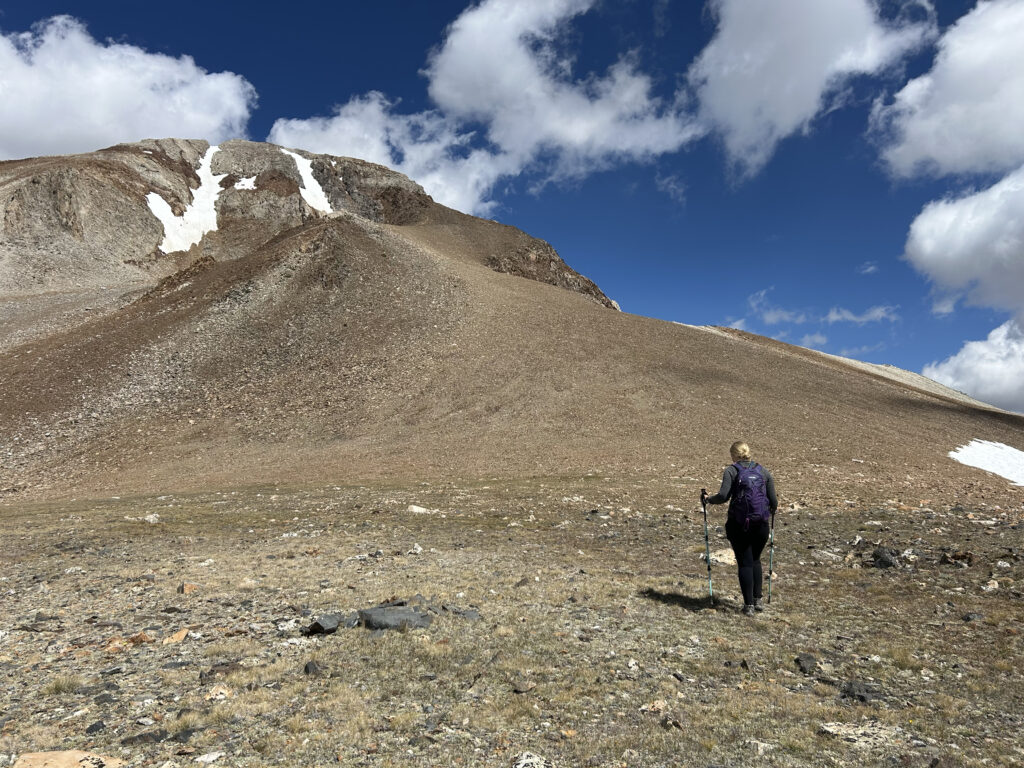
However, the alpine meadows were short lived and now we were on to the hard stuff. At this point the trail changed to slabs of rock (possibly slate?) instead of dirt, which made the footing a little trickier, and all of the vegetation fell away to reveal a Mordor-like landscape.
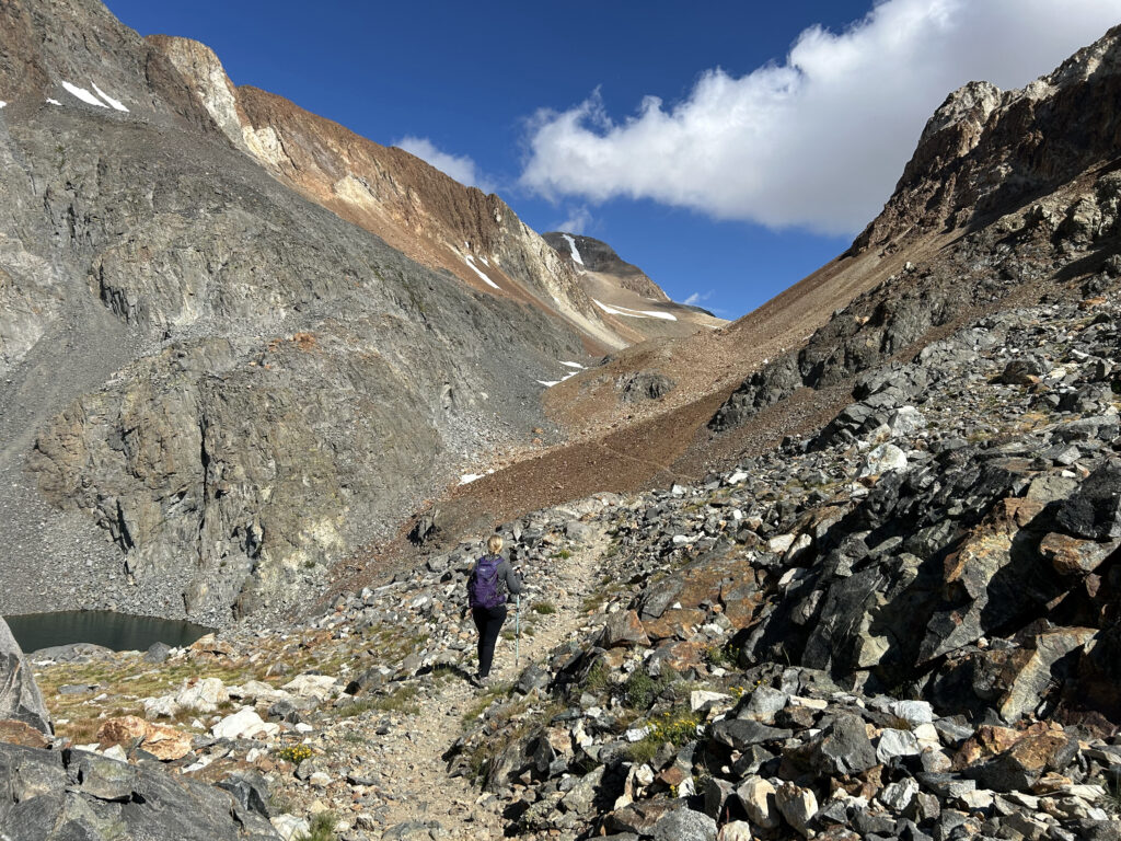
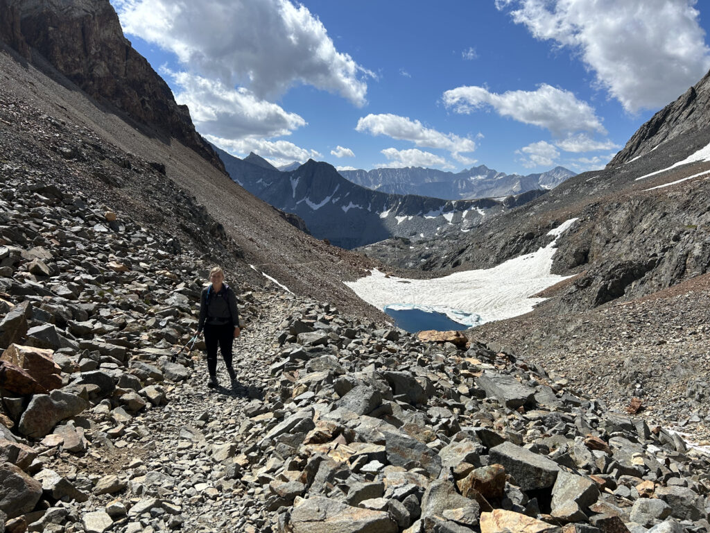
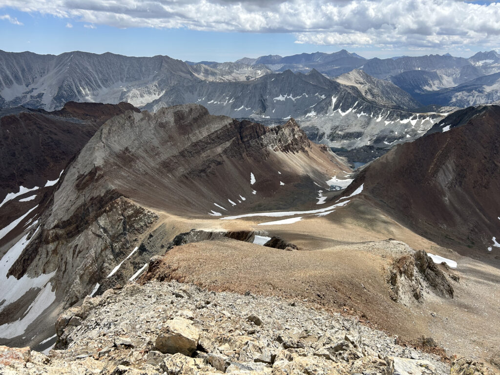
After navigating through this rock landscape for about an hour, we were then presented with a series of final switchbacks to the top of McGee Pass at 12,000 feet. As passes go, this one was not too difficult, especially with just daypacks. The altitude made it challenging but there couldn’t have been more than twenty switchbacks in total and we quickly made it to the top of the pass. From the pass you get some nice views down towards the John Muir Trail about three miles away, and possibly Lake Virginia (a highlight of the JMT) but I wasn’t positive since there are so many lakes in this region. At the pass we ran into a couple other parties doing small loops involving the JMT. We turned right (northwest) and saw the final objective ahead, just one mile away and a 1,000 feet above us. The summit of Red Slate.
The first part of the climb was a slog up a scree field. Nothing technical, but extremely tiring. There was a hiker up ahead with her Australian shepherd and it was demoralizing, but endearing to watch this young dog running up and down the mountain to check in on us. Once we got up the scree field we turned around to look back down at the pass and now understood why this was so difficult — the scree field was much steeper than what it looked like from the bottom.
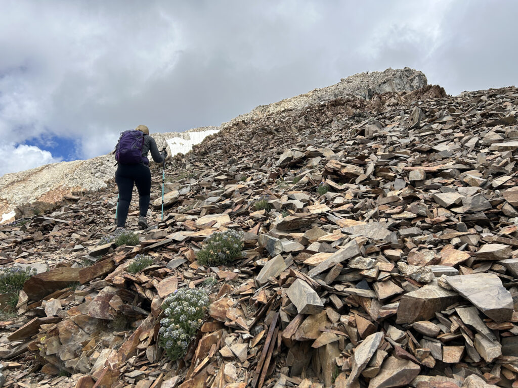
The climb then transitioned to a class 2 scramble. These are my favorite climbs because they have all of the fun with none of the danger — even the shepherd was enjoying himself. I don’t take nearly as many photos in these sections because I’m always either using my hands for balance or my phone for navigation, but here is one from when the class 2 section began:
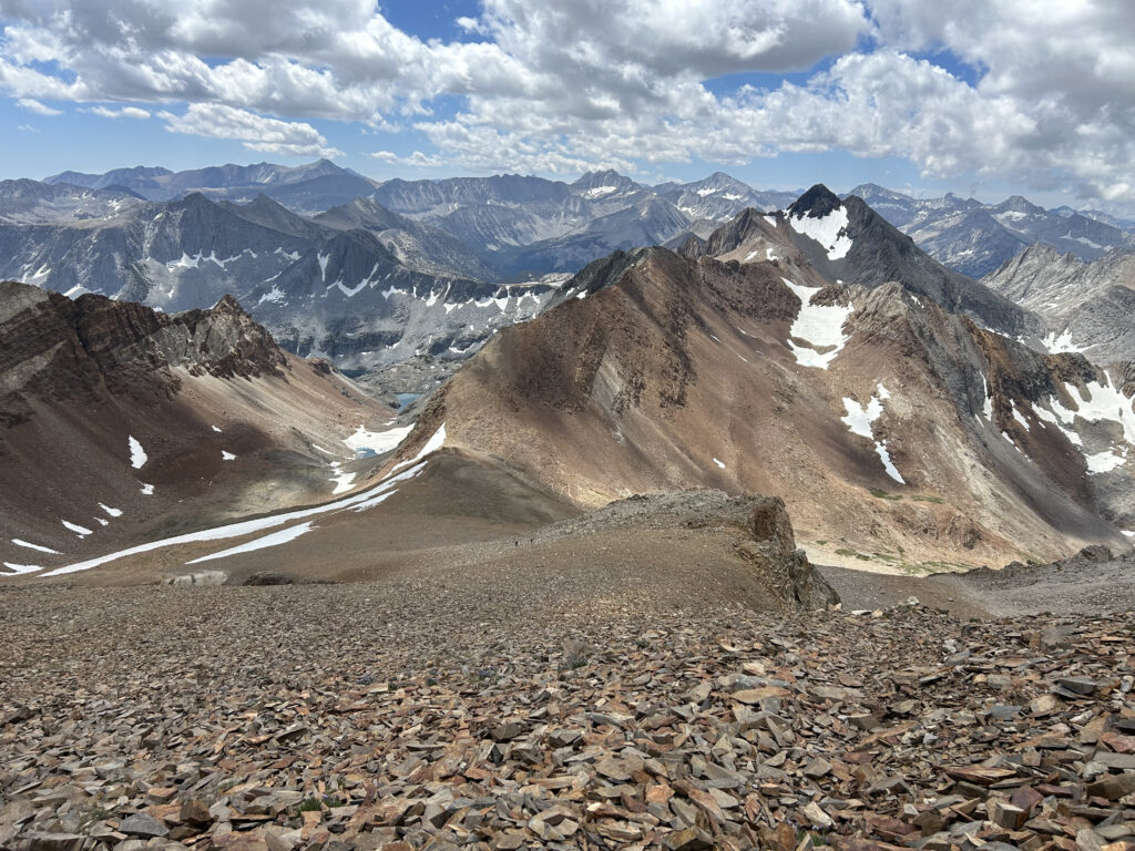
After about an hour from the pass we made it to the summit. The views were nothing short of spectacular and provided an interesting perspective of the area — I’m used to being this high up in the Mount Whitney area to the south, but this peak provided a fascinating vantage point of the Mammoth Lakes area, Mono Lake in the Owens Valley, and Mount Ritter and the northern sections of the John Muir Trail.
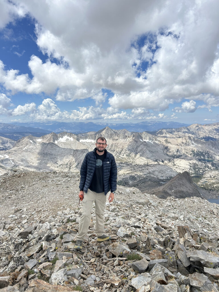
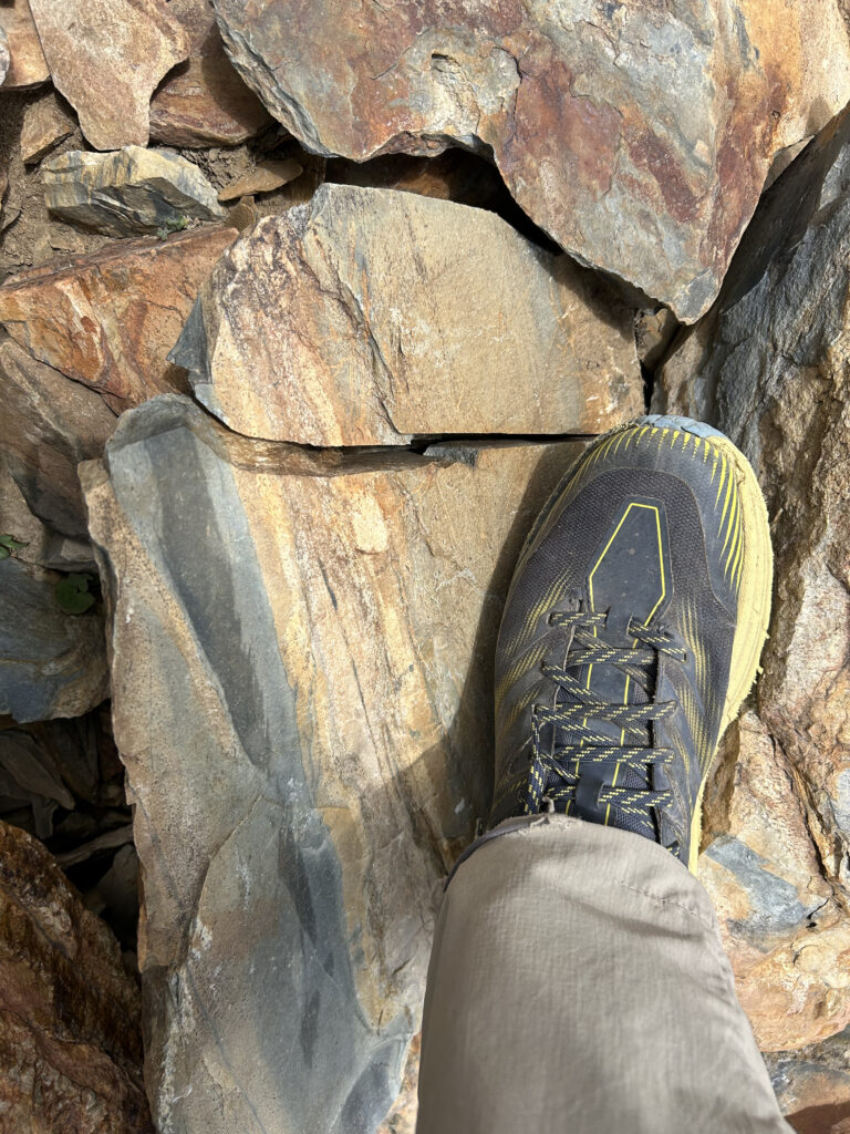
We rested for a half hour at the summit, signed the summit registry, got to listen to the Australian shepherd howl for Chloe’s meat stick, and then began the climb down. The climb down to McGee pass was quite slow due to the careful technical downclimbing, and so I wasn’t surprised that we arrived back at the pass about an hour after we left the summit. On the way down I was impressed by the array of colors of the rocks (someone told us that a crystal mine was located nearby), and I was particularly attracted to one rock that had the exact same color scheme as my Hoka hiking boot.
After the pass we picked up speed for the walk down back to the trailhead. At this point our feet hurt from walking on rocks the last several miles, and it was around the 15 mile mark where I really had had enough and would’ve been just fine ending the hike right there. This coincided with the point where we re-reached Mosquito Lakes, and between the all around pain (I had taken 4 ibuprofen for the altitude and general soreness) and the bloodthirsty suckers that were giving us hundreds of bites, Chloe basically left me and it was every man, woman, and mosquito to himself/herself in getting back to the trailhead at breakneck speed.
We returned to the car at 4:50 PM, about 3 hours ahead of my prediction. Between the mosquitoes and Chloe not believing in non-summit breaks longer than 5 minutes, we finished so early that we could still drive back home that same day. We stopped at the Lone Pine McDonald’s on the way home, rated one of the tastiest McDonald’s in the world (by me), and collectively shared 2 snack wraps, 2 double cheeseburgers, fries, a Coke, and a coffee shake. Make America Healthy Again. Then it was back to the Lancaster Walmart to collect my car and the uneventful drive home.
If this trail (or any others) sounds appealing, we offer a variety of guided hikes and climbs in southern California (with plenty of stops and breaks to enjoy the scenery). Reach out to us here.