California’s diverse landscape offers some of the most spectacular hiking experiences in the world. From towering redwoods to dramatic coastlines and alpine lakes, the Golden State’s trails provide unforgettable adventures for hikers of all skill levels. Here’s our comprehensive guide to the five best hiking trails in California.
1. Half Dome Trail, Yosemite National Park
Trail Overview
- Distance: 14-16 miles round trip
- Elevation Gain: 4,800 feet
- Difficulty: Strenuous
- Best Time to Hike: Late May to October
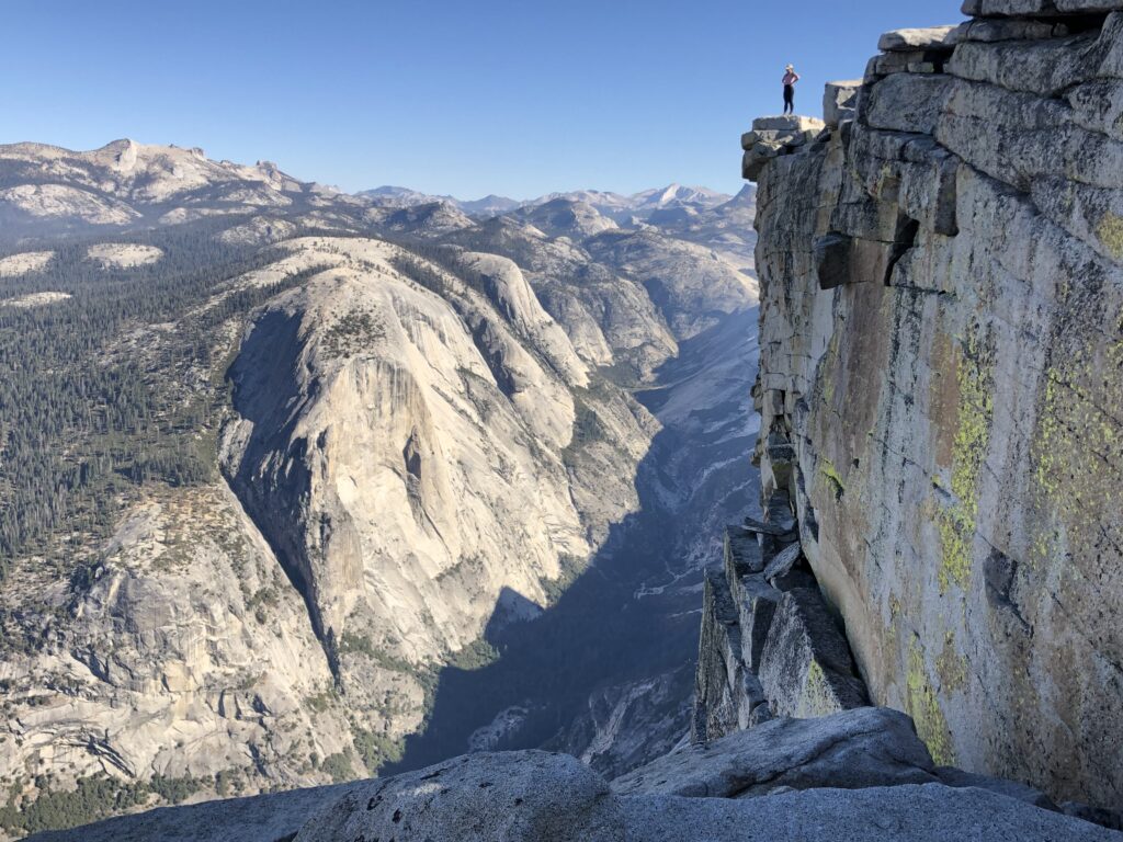
Second to none. The iconic Half Dome hike stands as one of California’s most challenging and rewarding adventures. This world-famous trail takes hikers through the heart of Yosemite Valley, offering breathtaking views of Nevada Falls, Liberty Cap, and the Sierra Nevada range. Note that the top section of the trail requires hikers to climb a set of cables — if you’re afraid of heights, this isn’t the trail for you. You also need to get a permit for Half Dome in advance, which involves either winning a day hike lottery or adding a Half Dome permit onto an existing Yosemite backcountry reservation (much easier). We’ve seen hikers who didn’t have a permit get turned around by rangers right before the cables section after hiking eight miles — don’t have this be you!
What Makes It Special
The final ascent up Half Dome’s cables provides an unforgettable climbing experience, while the panoramic views from the summit showcase Yosemite’s grandeur. Hikers must secure permits in advance, as only 300 people are allowed on the cables per day.
Practical Tips
- Start early (before sunrise) to avoid afternoon thunderstorms
- Bring proper gear for the cables section if you want to clip in (not required, or even necessary if you are confident with heights).
- Carry at least 3 liters of water
- Wear sturdy hiking boots with good traction
2. Rae Lakes Loop, Kings Canyon National Park
Trail Overview
- Distance: 41.4 miles loop
- Elevation Gain: 6,100 feet
- Difficulty: Strenuous
- Best Time to Hike: July to September
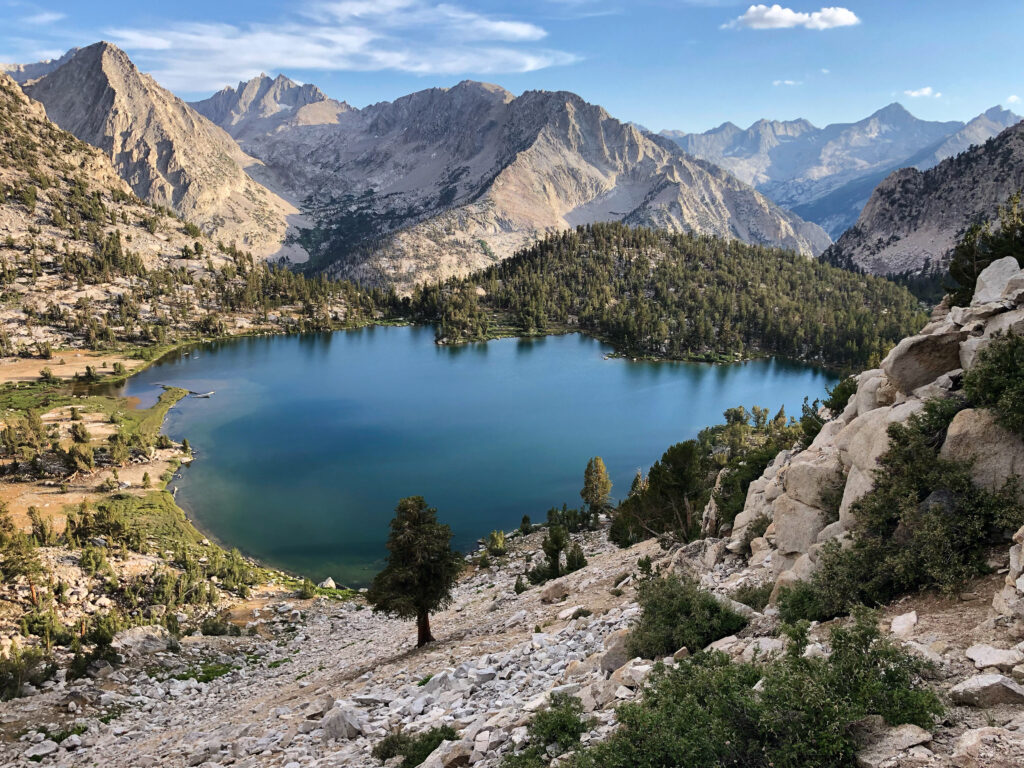
The Rae Lakes Loop stands as one of the most spectacular backpacking circuits in the Sierra Nevada. This challenging trail takes hikers through glacially carved canyons, past pristine alpine lakes, and over the 11,978-foot Glen Pass.
What Makes It Special
The trail showcases the best of the High Sierra, including crystal-clear mountain lakes, towering granite peaks, and lush meadows filled with wildflowers. The namesake Rae Lakes, sitting at 10,500 feet, offer some of the most dramatic mountain reflections in California.
Practical Tips
- Secure wilderness permits early from the Sequoia Kings Canyon National Park website (they’re in high demand)
- Bear canisters are required (we recommend the Bear Vault 450)
- Consider hiking clockwise for better altitude acclimation
- Plan for afternoon thunderstorms
- Best completed in 3-5 days
3. Lost Coast Trail
Trail Overview
- Distance: 25 miles one way
- Elevation Gain: 1,600 feet
- Difficulty: Moderate
- Best Time to Hike: May to September
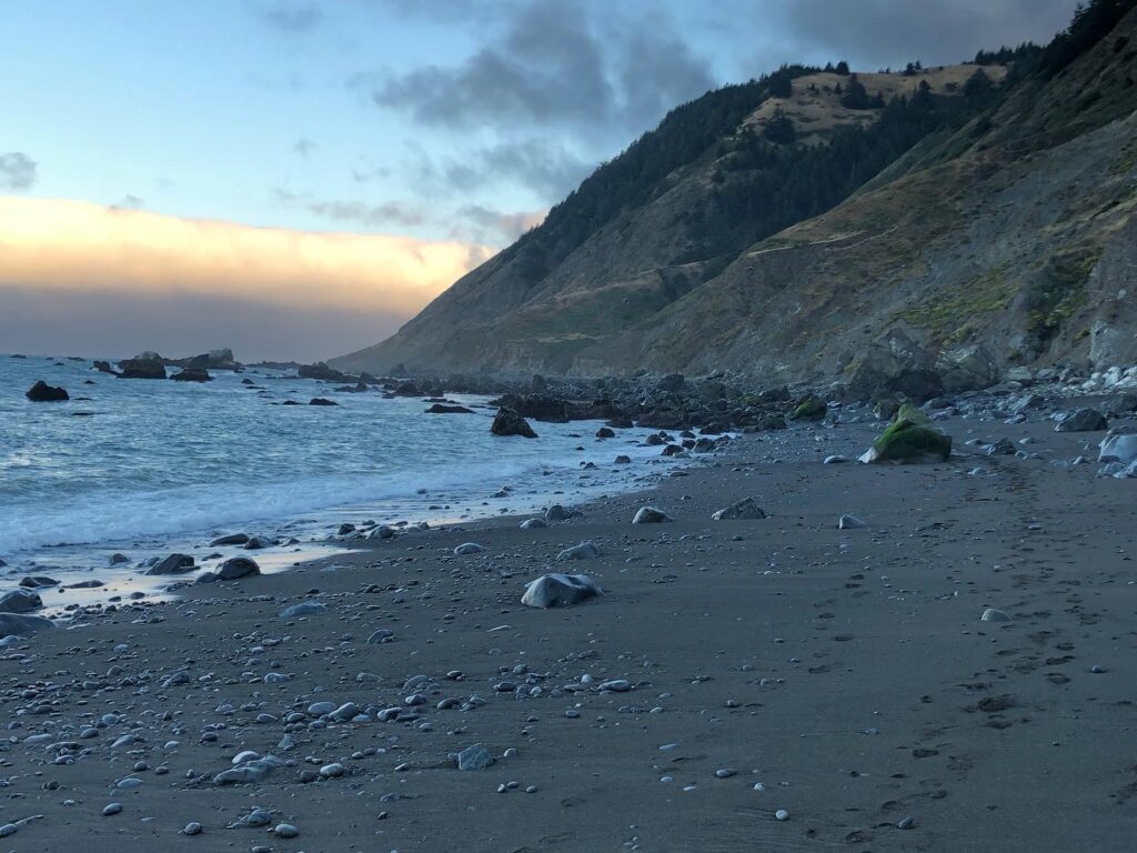
The Lost Coast Trail offers a unique hiking experience along California’s most remote coastline. This trail follows the rugged shoreline where the King Range meets the Pacific Ocean.
What Makes It Special
As one of California’s few coastal wilderness hiking experiences, the trail provides dramatic ocean views, black sand beaches, and opportunities to spot marine wildlife (including massive elephant seals).
Practical Tips
- Check tide tables before starting (some sections are impassable at high tide)
- Arrange shuttle transportation
- Bring weather-appropriate gear
- Secure permits in advance
4. Mount Whitney Trail
Trail Overview
- Distance: 22 miles round trip
- Elevation Gain: 6,100 feet
- Difficulty: Very Strenuous
- Best Time to Hike: July to early October
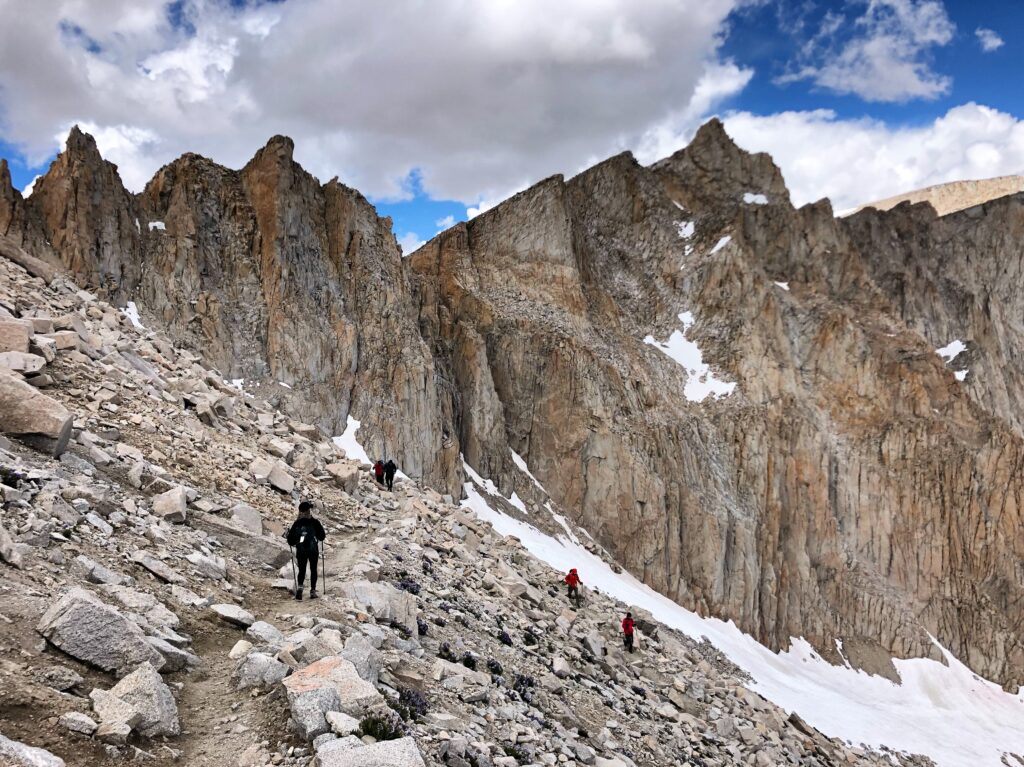
As the highest peak in the contiguous United States, Mount Whitney presents an ultimate hiking challenge. The trail to its 14,505-foot summit is both technically challenging and spiritually rewarding.
What Makes It Special
Summiting Mount Whitney offers hikers the chance to stand on the highest point in the lower 48 states. The trail provides extraordinary views of the Sierra Nevada and the Owens Valley.
Practical Tips
- Secure permits through the lottery system (even if you lose the lottery, check back often to look for cancelled permits!)
- Acclimate to the altitude before attempting. It helps to stay an extra night at Whitney Portal campground before starting.
- Start very early to avoid afternoon storms (we recommend 2 AM!)
- Bring proper winter gear even in summer
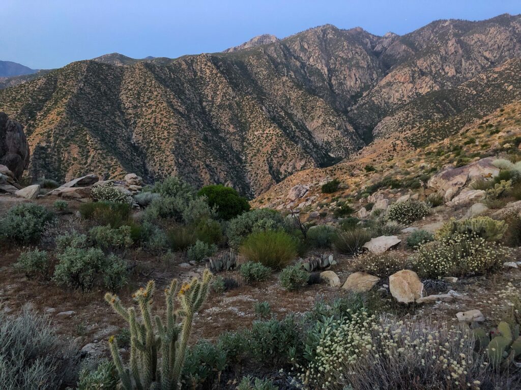
5. Cactus to Clouds Trail, Palm Springs
Trail Overview
- Distance: 21 miles round trip
- Elevation Gain: 10,300 feet
- Difficulty: Extremely Strenuous
- Best Time to Hike: The shoulder seasons, ideally May or November. Check the weather at both the summit and desert (Palm Springs), which can be 60 degrees different. Do not attempt this in the summer. People have died in the summer in the desert section.
The Cactus to Clouds Trail boasts the greatest elevation gain of any day hike in the United States. Starting from the desert floor in Palm Springs (near sea level!) and climbing to San Jacinto Peak, this epic trail takes hikers through multiple climate zones.
What Makes It Special
This legendary trail offers an extraordinary experience of ascending from desert cacti at 400 feet to an alpine environment at 10,834 feet. The dramatic elevation change provides unique perspectives on Southern California’s diverse ecosystems and spectacular views spanning from the Salton Sea to the Pacific Ocean on clear days.
Practical Tips
- Start very early (typically 1-2 AM) to avoid desert heat. May and November are ideal months to do the whole trails, since the desert is not too hot and the summit is most likely not in knee deep snow. Even when we did the trail in May, the desert was still in the 90s in the middle of the day and it snowed at the summit.
- Carry at least 4-6 liters of water. You can refill at San Jacinto State Park near the tram station, but you want plenty of water to get through the desert section.
- Pack microspikes in winter months
- Take the aerial tramway down (recommended). We want to do the Cactus to Clouds. Save the Cactus to Clouds to Cactus (aka C2C2C) for another day when the Cactus to Clouds is too easy for you.
- Check weather conditions carefully before attempting
- Train extensively before attempting this challenging trail
Essential Planning Tips for California Hiking
Best Times to Hike
- Coast: Year-round with best conditions from June to September
- Mountains: July to September for snow-free trails
- Desert: October to April for moderate temperatures
Safety Considerations
- Always check current trail conditions
- Inform someone of your hiking plans
- Carry essential safety gear
- Bring more water than you think you’ll need
- Check weather forecasts before departing
Required Permits
- Research permit requirements well in advance
- Popular trails often require lottery entries
- Some trails have quota systems during peak seasons
- Carry permits with you while hiking
Wildlife Awareness
- Store food properly in bear country
- Make noise to avoid surprising wildlife
- Know what to do in case of encounters
- Respect wildlife viewing distances
Conservation and Trail Etiquette
Remember to follow Leave No Trace principles while hiking these beautiful trails:
- Pack out all trash
- Stay on marked trails
- Respect wildlife
- Avoid making campfires. Campfires are never allowed in the backcountry above 10,000 feet, and are severely restricted in most parts of California in all but the wettest of years. Always cook on a stove.
- Be considerate of other hikers
These five trails represent the incredible diversity of California’s hiking opportunities. From coastal wanderings to mountain summits, each trail offers unique challenges and rewards. Remember to properly prepare, respect the environment, and embrace the adventure these wonderful trails provide.