Overview
For those who have found Mount Whitney from the Whitney Portal too easy, are looking for a less crowded alternative, or don’t want to deal with the Whitney permitting process, you may want to consider Mount Williamson, California’s second highest peak at 14,379 feet. Strictly speaking, the two peaks should not be considered substitutes. Mount Williamson is unquestionably the harder of the two for a multitude of reasons — the approach is longer, the starting elevation is lower, multiple sections are class 2-3 (Whitney Portal is class 1 the entire route), there’s cross country and route finding, and Williamson has an awful chute and chimney.
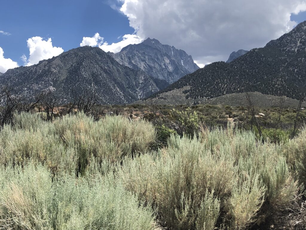
But it’s totally worth it. This demanding alpine adventure offers breathtaking panoramic views across the Owens Valley and the entire Sierra range. Located in the John Muir Wilderness near Lone Pine, Mount Williamson delivers an unforgettable backcountry experience with its remote approach, technical sections, and stunning mountain vistas. Plan your expedition between July and September for optimal climbing conditions on this bucket-list California fourteener.
Interested in booking this trip with a guide? Contact us here.
The Route
My climbing friend (George) and I climbed Mount Williamson back in July 2020. We followed the Alltrails route here, which we found to be pretty accurate in guiding us up the peak. It’s beautiful, but an absolute slog — nearly 27 miles round trip with 10,100 feet of elevation gain. Once you hit the top of Shepherd Pass, about 10 miles in, there is no trail, it’s cross country to the base of the mountain and up the chute, through the chimney, and on to the summit.
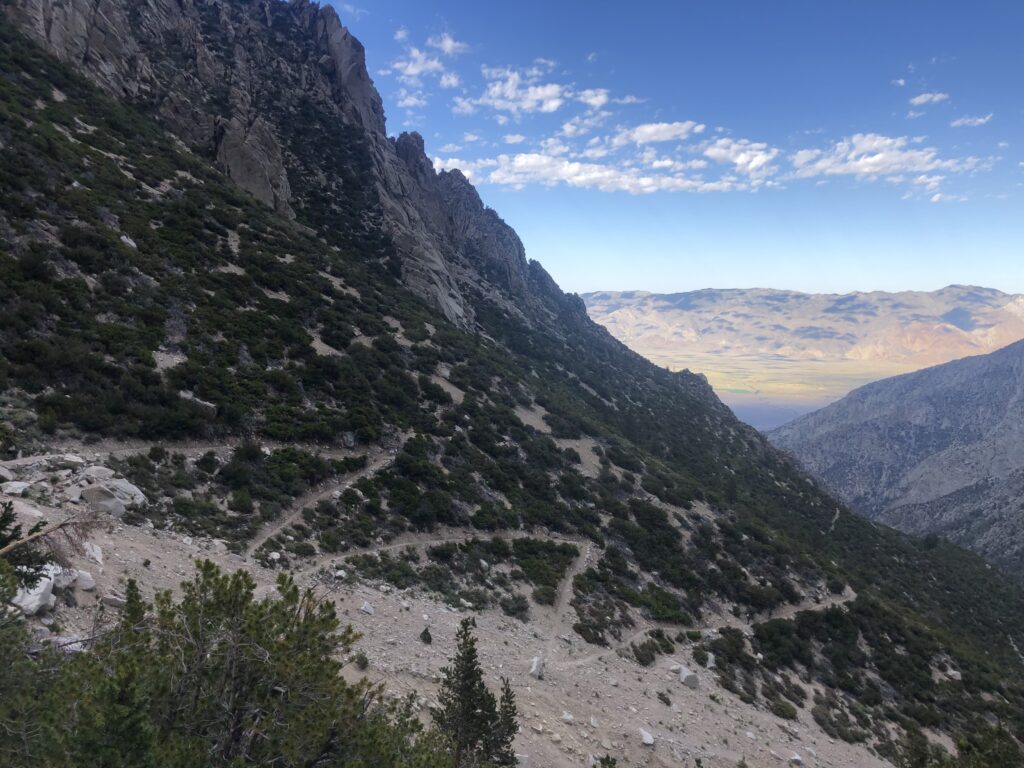
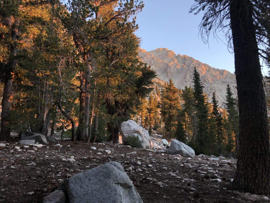
There are two places to park, the official start of the trail which is only accessible to 4WD vehicles at around 6,300 feet above sea level, and the 2WD/stock parking area about a mile down at around 5,700 feet above sea level. I’ve parked in both locations, once at the 2WD spot with my Honda Civic and a second time when I did Tyndall at the actual trailhead (and had a small SUV). The 4WD isn’t bad, is a fairly short section, and most high clearance vehicles could do it easily. If you do park at the lower lot, make sure you start early because the intro section is full on scrub desert and bakes immediately when the sun comes up. Once you get to the actual trailhead there is shade and water again from Symmes Creek.
The Trip
George and I did this trip as a 3 day 2 night, but you could conceivably do it in 2 long days. I highly advise against doing this in a single day, although I’m sure there are elites out there who have. Like all travel in the eastern Sierras, the mileage is misleading — with the high altitude and cross country everything takes longer.
We met at the 2WD trailhead and started up the scrub trail to the official start of Shepherd Pass. It was 8 AM so the sun was just above the mountains and it wasn’t too hot… yet. When you get to the trailhead, things start to get more interesting. Shepherd Pass Trail winds its way through the canyon carved out by Symmes Creek and you’re never too far away from the sound of rushing water and the occasional tree for shade. There are a few stream crossings which would be bad in the highest of snow years, but given that the snow was only moderate that winter, they were all easily manageable and didn’t go above the knees or could be rock hopped.
Eventually, you leave the stream at around 7,000 feet elevation (make sure you get enough water to last to Anvil Camp!) and you begin the switchbacks up to Symmes saddle. This section is actually fairly pretty with open views down the canyon and the occasional shade from the pines on the switchbacks to distract you from the climb. We got to the top of Symmes saddle, which is a great place for a snack and gives you an excellent, and somewhat terrifying view of Mount Williamson. Mainly because you’ve climbed so much and Mount Williamson is still so far up above. One also sees the sheer spires of the peak and wonders how one would get to the summit (you approach from the backside).
At Symmes Saddle, we realized an agonizingly painful fact — the trail goes back down. Not terribly so, only about 400 vertical feet, but the trail winds down for about a mile and it was the last thing we wanted to be doing on a 14er, bopping back and forth in the 8-9k range. Furthermore, we could see and hear Shepherd Creek off to the left, but it was hundreds of feet below us so there was no chance to refill water or cool off in the stream. It was now the heat of the day and the full sun was beating down, sweat was running down my temples and we marched on in silence, hoping to get to some tributary or thicket of shade to rest.
Eventually, the descent ended and we began the switchbacks up to Anvil camp. There had been some rockslide activity recently so the trail had been rerouted in a few places (making the already long switchbacks even longer), but it was all clearly marked and the detours were annoyances rather than points of confusion.
Then, we entered a patch of forest, heard the sound of running water again and realized we had made it to Anvil Camp.
Anvil Camp is a mountain oasis (albeit, a mosquito infested one) on the Shepherd Pass trail. Below, there’s lots of scrub, no shade, and the beating sun. Above, there’s only rock, exposure, and cold and windy conditions. Anvil Camp is about 10,300 feet above sea level, making it about the halfway point in terms of elevation (but not difficulty!) and a natural stopping point for a 3 day 2 night trip (since you can leave your base camp gear at this spot and take a daypack to the summit and back). If you are trying to do Williamson in just 2 days 1 night, I highly recommend camping at the top of Shepherd Pass since it’ll set you up in better position to bag the peak early the next day (so long as the weather is good). Remember, because of afternoon storms you’ll want to start early (before sunrise) and get off the higher summits by noon (and always watch the sky for towering storm clouds).
We had a nice meal of dehydrated trail food (I forget which flavor), hung out, and then went to bed early from the fatigue. The next morning we started at around 8 AM, knowing what lay ahead I definitely would’ve started earlier.
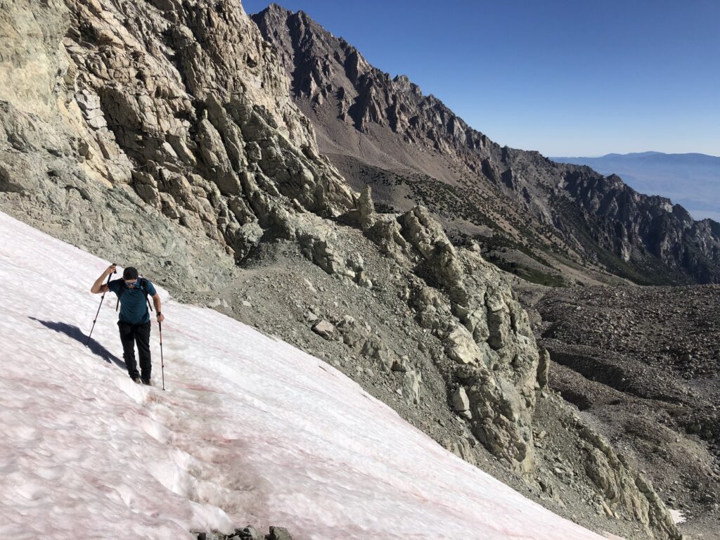
The first part after Anvil Camp was simple enough. We continued the steady ascent up Shepherd Pass, the trees thinning until it was just rock. Beyond looms the final ascent up Shepherd Pass, which looks like a sheer wall from far away. When we got to the wall, there’s an evident set of switchbacks to the top, but a lot of them are suggestions and climbing them is more akin to climbing a gravel pit than an actual trail. Near the top of the switchbacks the trail flattens, but it brought us to a fairly pitched snowfield that extended fifty or so feet down the mountainside. We had not brought microspikes to save weight, and although I don’t regret the decision, I was a teensy bit nervious tip-toeing my way across the snowfield. Luckily, it was warm and the snow was fairly melted, so there wasn’t too much of a danger in falling. After the snowfield, we had made it to the top of Shepherd Pass.
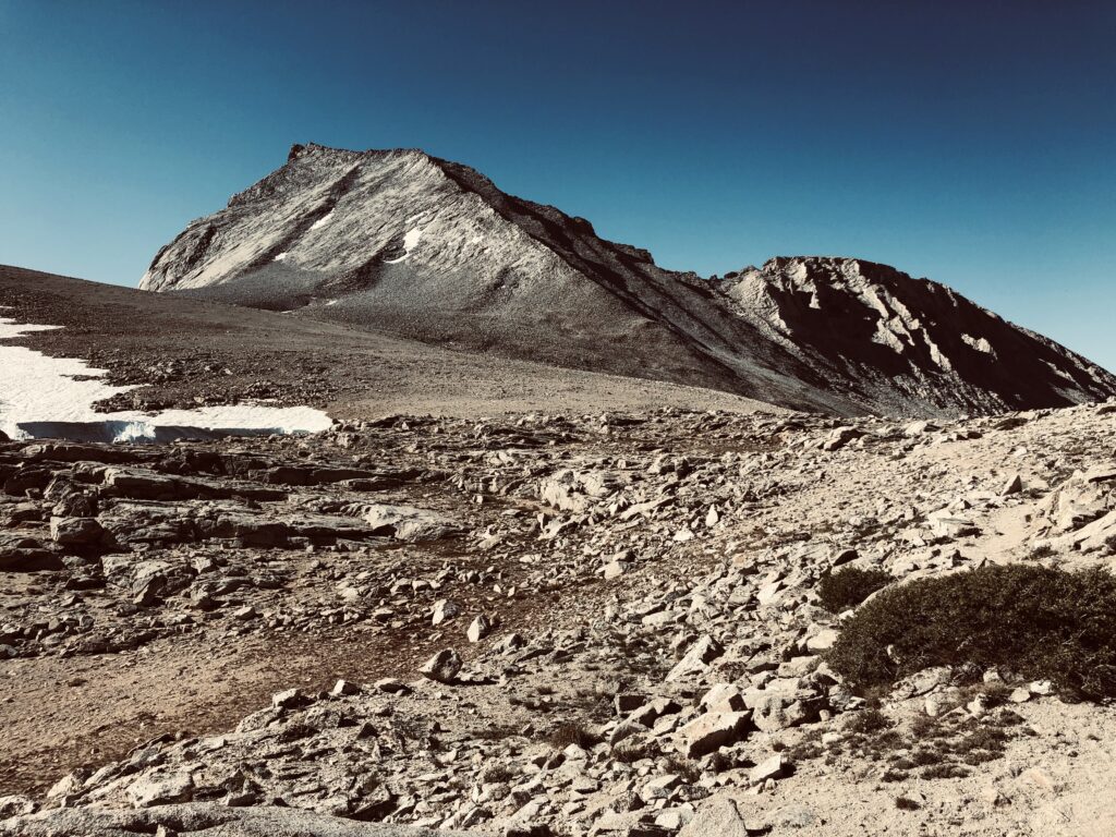
Shepherd Pass it quite exciting. Here you’re on the top of an immense, alpine plain with incredible views of Mount Tyndall with its Class 3 ridgeline to the south (a great climb for another day), Williamson still impossibly far away to the southeast, an especially prominent peak to the west named Milestone Mountain, and the John Muir Trail only a few miles away down the pleasantly sloping valleys to the southwest. The approach from the JMT side takes even longer, meaning that you’ve really made it to somewhere that few people in the world ever see. This is Bighorn Sheep country, so if you have the stamina to carry a pair of binoculars up the pass (I did not), you’d have a great vantage point to survey the landscape.
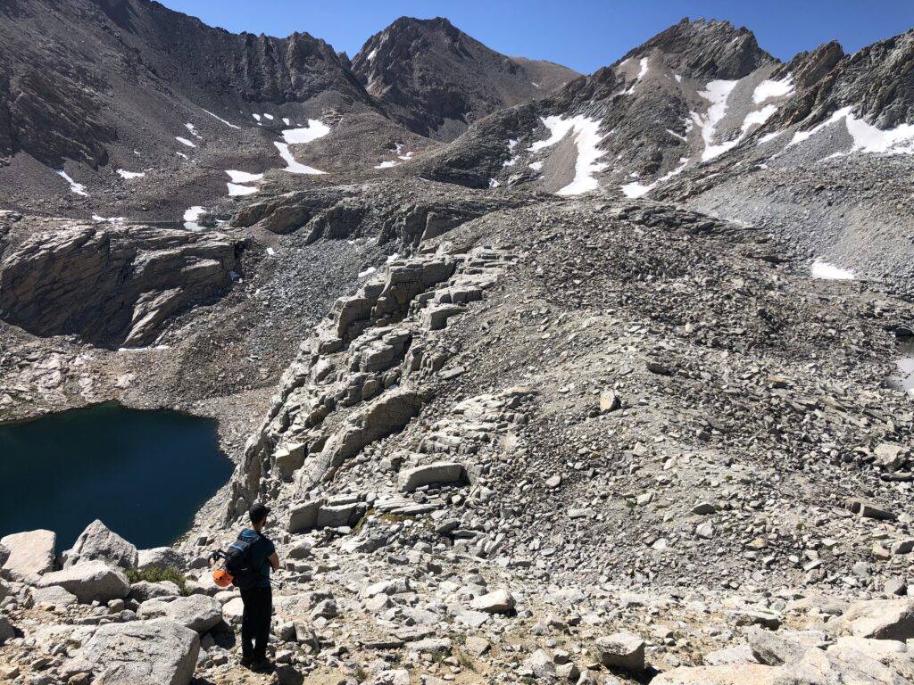
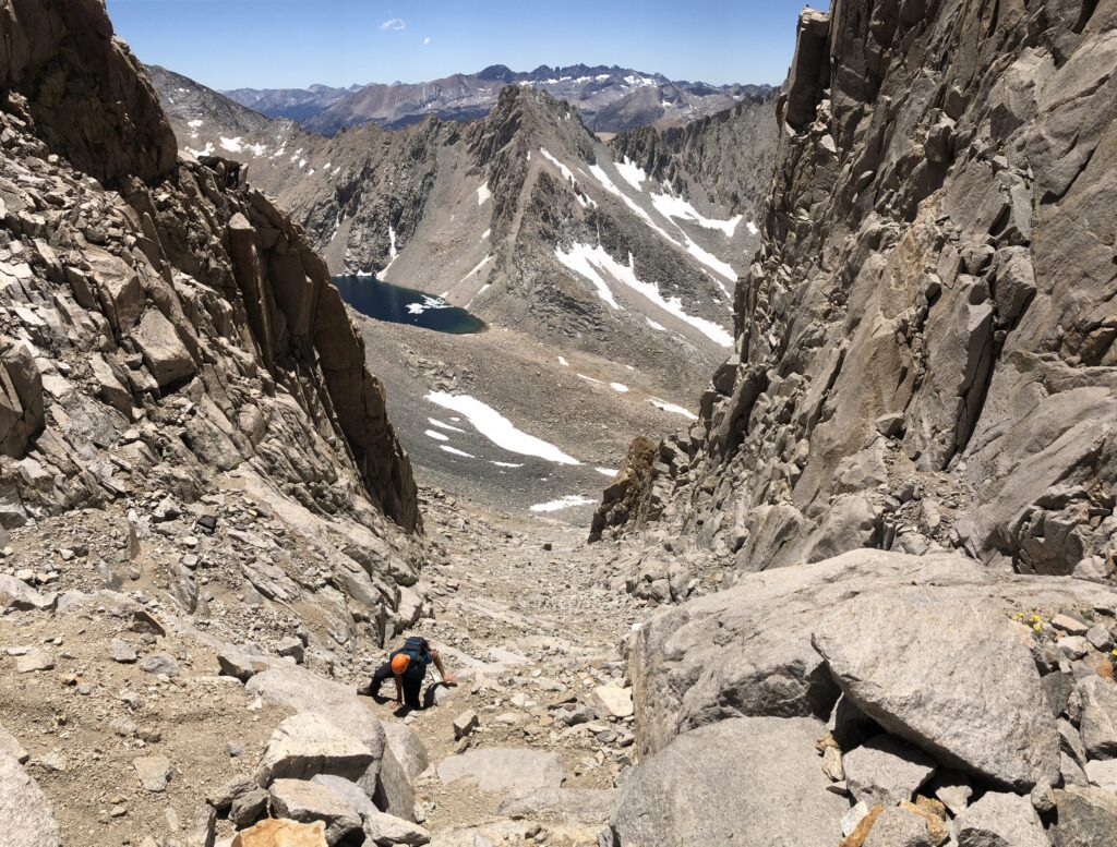
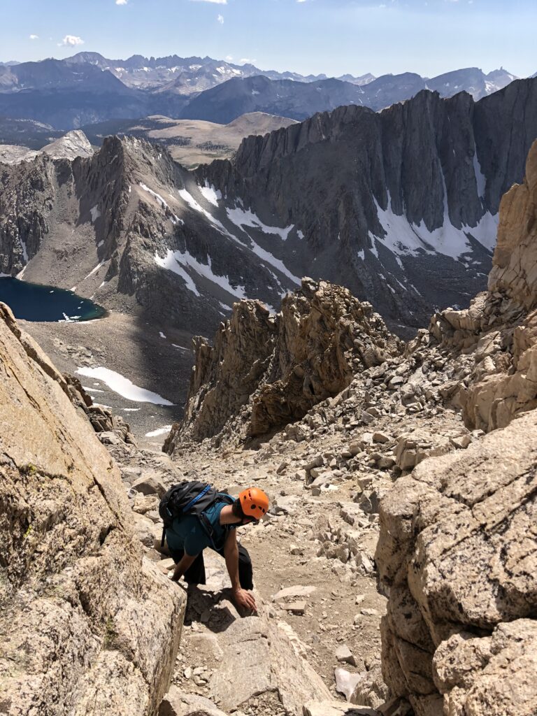
Now begins the hard part, the cross country section. We made our way up the plain to the Williamson Bowl, and after 30-45 minutes made it to the lip of the bowl. Looking down, we were dismayed. The topographic map says it’s flat and only one mile through the bowl, but what the map didn’t convey is that the bowl is littered with hundreds, thousands of jumbled piles of talus that are impossible to walk around. You must scramble your way through the talus. Even though there’s very little elevation gain in this section, it was incredibly tiring navigating just the one mile to the base.
Once we got through the talus, we reached the base of the true climb. There’s a lot online about how to spot the correct chute to climb through, we found that between Alltrails and the sheer width of the main chute that it was pretty obvious which one to go up. The chute is absolute garbage. George and I were cursing on the way up, there’s no solid footing (it’s more Sierra gravel) with the occasional bowling ball sized rock to dislodge and rain down on an unsuspecting climber below. We were lucky to not have anyone climbing below us and were very careful to not climb in each other’s fall lines. It’s very different from climbing Williamson’s neighbor, Tyndall, which has solid granite slabs and cracks to hold onto. This was just a pile of loose dirt with some hundred pound rocks thrown in. After about 1,000 vertical feet of this we made it to the chimney, which is at just about 14,000 feet.
There’s also a lot on the internet about this chimney/keyhole, the non-eroded section of the mountain that you’ll find at the top of most of the Sierra peaks. People are very worried about this part, about whether to call it Class 3 or even 4, and rightly so, since it’d be a real shame to have to turn back after going all this way. I had worked myself up so much about this part that when we finally got to it, it wasn’t all that bad. It’s about 30-40 feet long, and even though there are a couple technical maneuvers it’s very obvious where you’re supposed to go, and the multiple shelves on the way up allow for ample opportunities to rest and recover, and to break up your descent in case you land into trouble. I left my pack at the base of the chimney to be extra cautious, but if you had a small climbing pack there would be no problem getting through.
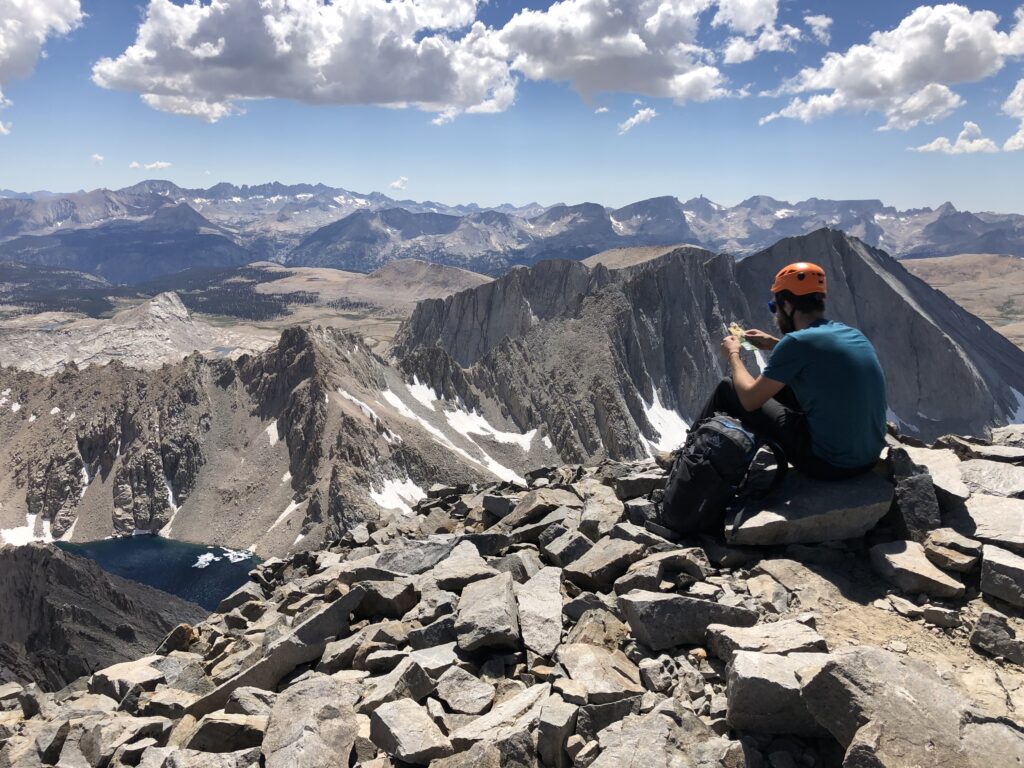
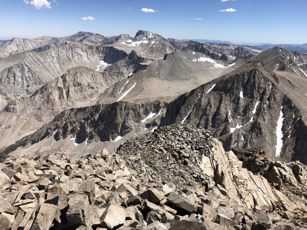
At the very top you climb through the keyhole and behold! Another summit plain. Not what I was expecting, but Mount Williamson has a few different summits poking out from a plateau. The one you want is the true summit, to your right when you get out of the keyhole (and to the south). At this point, you only have 300 vertical feet to go and it’s an easy talus scramble to the top.
The summit is spectacular. We were on the second highest peak in California, the highest thing around for miles with no one else in sight. The Owens Valley and 395 is far away to the east, with Whitney in plain view to the south. You can see the long, torturous route back to Shepherd Pass and the entire Sierra range extending west to the Central Valley.
Of course, like most of the challenging summits, we were not able to stay long. Twenty minutes later we were scrambling back down the talus, down the chimney (down was not significantly harder than up with the many shelves) and down the chute. We had to be super careful on the chute, rocks were getting dislodged everywhere, and at one point while I was sitting on a large flat boulder, waiting for George, the boulder dropped out from under me and I hit the gravel hard, watching the boulder tumble to a new resting spot fifty feet below. I was thankful to get out of there. Now, it was just the long, slow ambling through the Williamson Bowl and the journey back down Shepherd Pass.
We reached Anvil Camp at around 8 PM, about twelve hours after we started. It took about 12 hours to go 10 miles from Anvil Camp to the summit and back, which really isn’t bad, considering that one time in the Eastern Sierra while climbing Sill it took me 4 hours to go 1 mile. We made dinner, promptly passed out, and spent about half a day the next morning descending from Anvil Camp back to the car. All in all, a pretty excellent trip!
Interested in booking this trip with a guide? Contact us here.